top of page


Westbrook, CT
Westbrook is home to over 10 preserved properties and trail systems, including those managed by the Westbrook Land Conservation Trust and the town. Trails here pass through forested open space, tidal marshes, and river corridors. The town also includes coastal access points and portions of the Stewart B. McKinney Wildlife Refuge. Westbrook’s trails offer a quiet mix of shoreline and inland walking routes.
The Land & Trails
Natural Landscape
Westbrook’s landscape includes tidal creeks, salt marshes, dense woods, and small inland hills. Some trails run alongside rivers or marshes, while others wind through quiet pine and hardwood forests. The proximity to Long Island Sound influences the scenery, with breezes and shifting light near the water. Inland trails often follow old logging paths or natural ridgelines. The variety makes for peaceful, uncrowded walks through different habitats.

Image Credit: homes.com
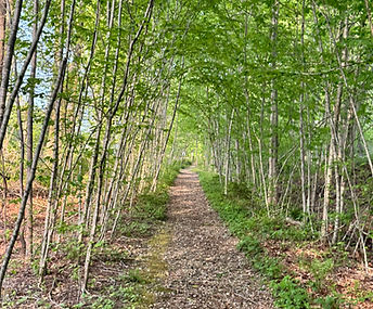
Image Credit: Shoreline Hikes
Notable Hikes
Top spots in Westbrook include Chapman Mill Pond Open Space, Tom O'Dell Memorial Open Space, Horse Hill Woods, and the Westbrook Town Forest. Each offers well-marked trails and quiet natural surroundings. The Salt Meadow Unit of the Stewart B. McKinney Wildlife Refuge features boardwalks and riverside paths through coastal habitat. Many trails are short loops or out-and-back paths, making them easy to explore without needing a full day. While the elevation is modest, there’s still variety in the terrain and views.
Seasonal Highlights
In spring, trails near the wetlands fill with birds and blooming wildflowers. Summer brings shade in the inland forests and salt air along the marsh trails. Fall is colorful, especially at Horse Hill and Mill Pond, with reflections across the water and changing leaves overhead. Winter is a calm time to explore, with clearer views through bare woods and little foot traffic. Most of Westbrook’s trails remain walkable in all seasons.

Image Credit: CT.gov
The Land & Trails
Local History
Westbrook’s trail areas pass through land that was once used for farming, timber, and shoreline travel. Stone walls and old field clearings are still visible in places like the Town Forest and Chapman Mill Pond. The Salt Meadow unit of the wildlife refuge once served as a salt haying area and later as part of a Cold War listening post. Historical markers or remnants are found in a few preserves, especially near older town roads. Much of the preserved land reflects the town’s shift from working land to protected open space.

Image Credit: Westbrook Historical Society

Image Credit: WLCT
Conservation & Land Trust
The Westbrook Land Conservation Trust works to protect land and water throughout town and manages several public-access preserves. The town itself also maintains multiple trail systems and open space properties. Their efforts help protect wetlands, forest corridors, and shoreline views while keeping access open for residents and visitors. The Salt Meadow Unit is federally managed and adds another layer of conservation through habitat restoration and environmental education. Combined, these efforts give Westbrook a strong, community-focused trail system.

Image Credit: Westbrook, CT

bottom of page